
Tucked between the misty peaks of the Alborz mountain range and the lush lowlands of Gilan province, Chakrood Valley is one of northern Iran's best-kept secrets. This river-carved gorge stretches between the town of Rahimabad and the village of Teyula, offering visitors a rare combination of dense Hyrcanian forests, thundering waterfalls, and crystalline mountain streams that seem almost otherworldly in their beauty. For travelers seeking an off-the-beaten-path experience in the Iranian Caspian region, Chakrood Valley delivers an unforgettable journey into one of the most biodiverse landscapes in the Middle East.
Where Is Chakrood Valley?
Chakrood Valley sits in the heart of Gilan province in northwestern Iran. The valley begins upstream from the town of Rahimabad and from the area around the village of Teyula, located in the Ashkurat region of Rudsar County. From there, it slopes down toward the Caspian Sea, following the course of the Chakrood River.
Rahimabad itself is a small town nestled in the foothills of the Alborz mountains, approximately 35 kilometers southeast of Ramsar and about 40 kilometers from Rudsar. The valley forms a natural corridor through which the Chakrood River flows, fed by mountain snowmelt and seasonal rains that keep the waterway vigorous throughout spring and early summer.
The region enjoys a subtropical Caspian climate, meaning humid, mild weather for much of the year. Summers are warm but never oppressively hot, while winters bring cool temperatures and frequent rainfall that transforms the surrounding hillsides into a tapestry of green. This climate supports one of the world's oldest and most unique forest ecosystems: the Hyrcanian forests, which date back over 25 million years and are recognized as a UNESCO World Heritage Site.
The Chakrood River and Its Waterfalls
The lifeblood of the valley is the Chakrood River, a fast-flowing mountain stream that cascades down from the Alborz heights. Along its course, the river passes through a series of rocky gorges and natural pools, creating several waterfalls of varying size. The tallest and most impressive of these stands at approximately 30 meters, plunging over a moss-covered rock face into a misty basin below. The sound of falling water echoes through the narrow canyon, mixing with the calls of birds that inhabit the surrounding forest canopy.
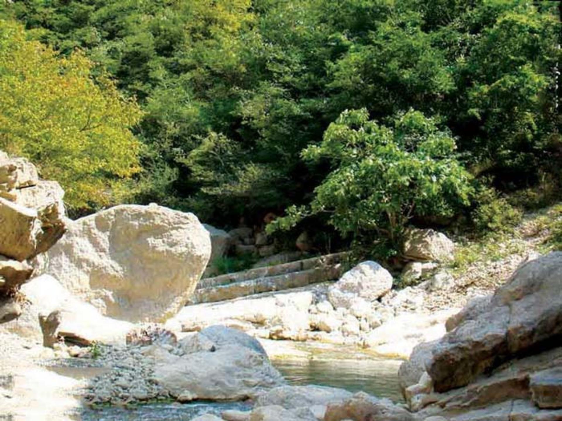
Smaller cascades and rapids dot the river's path upstream and downstream from the main falls. In spring, when snowmelt is at its peak, the water volume swells dramatically, turning moderate trickles into powerful torrents. By late summer, the flow diminishes to a gentler pace, revealing smooth rock formations and tide pools teeming with small fish and aquatic plants.
The water is remarkably cold year-round, a product of its mountain origin and the shaded forest cover that keeps the channel cool even on hot August days. Local residents and experienced hikers sometimes fill water bottles directly from clean tributary streams, though visitors should always verify water safety before drinking from natural sources.
A Landscape Shaped by Water and Time
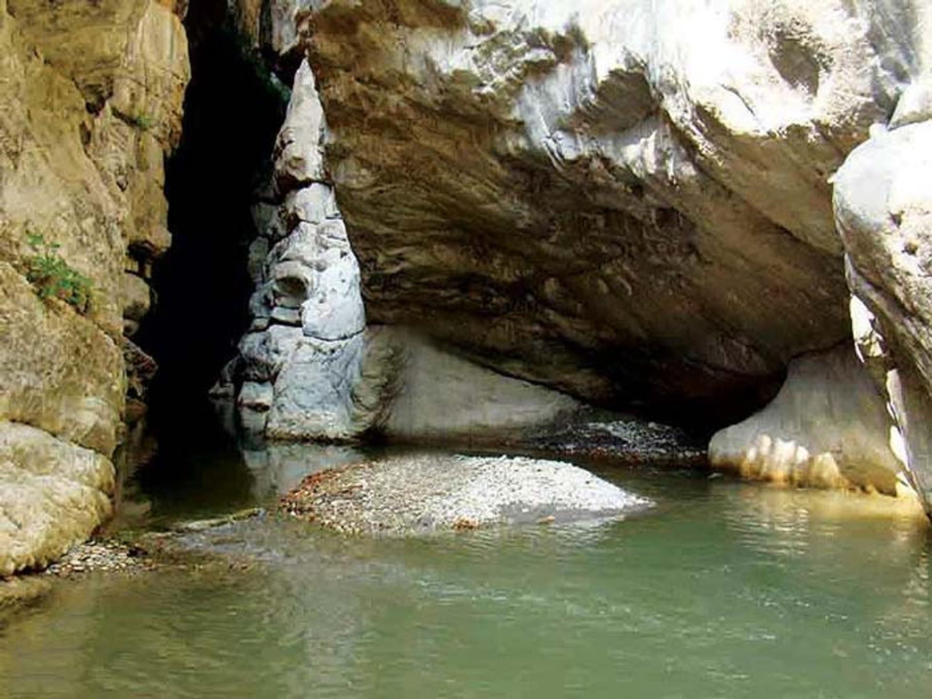
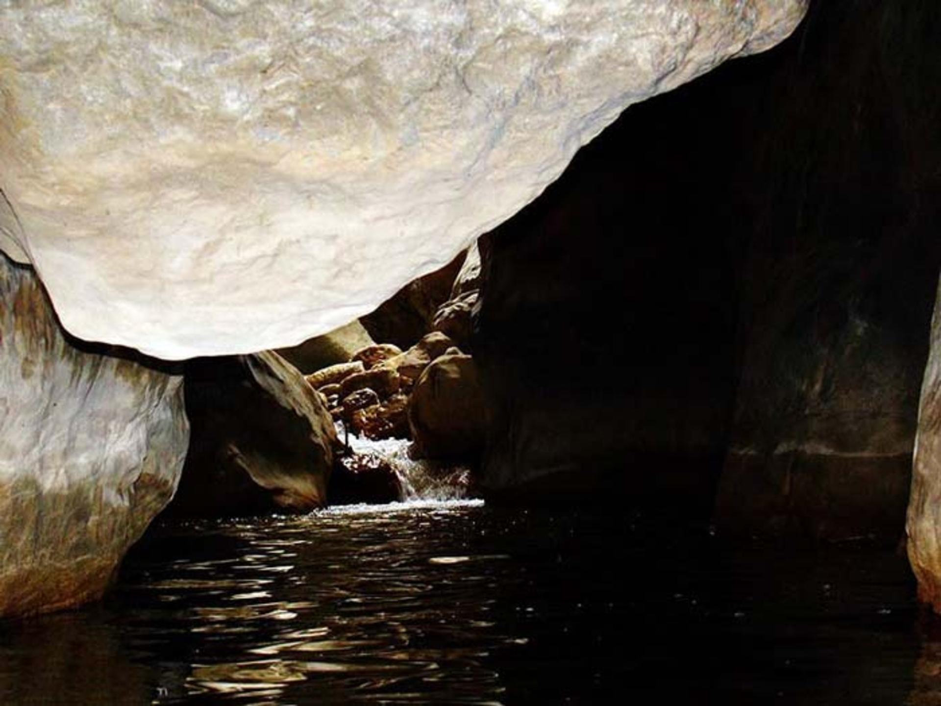
The valley is a textbook example of a river-carved V-shaped gorge, formed over centuries by the erosive power of seasonal floods. The sedimentary layers of the canyon walls are clearly visible, revealing geological strata deposited over millennia. In some sections, boulders that have tumbled from the ridge above become wedged between the two walls, forming precarious natural bridges that span the gap. These stone arches are as beautiful as they are treacherous, and crossing them requires sure footing and a head for heights.
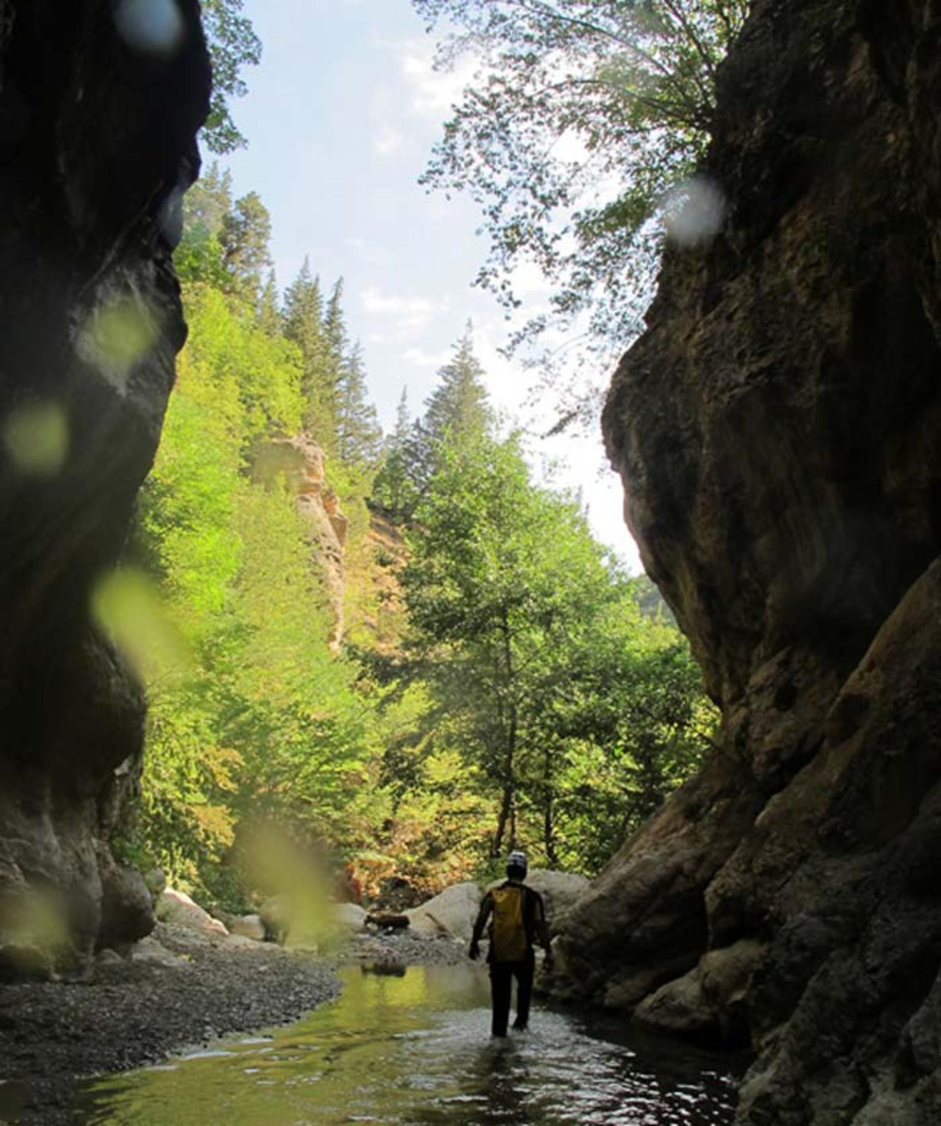
Deep inside the gorge, sunlight barely reaches the river floor. The darkness, combined with the echo of rushing water and the chirping of crickets, creates an atmosphere that is both thrilling and humbling. This is a landscape that demands respect, and those who enter it properly equipped will find themselves rewarded with one of the most dramatic natural settings in northern Iran.
Access Routes to the Valley
Reaching Chakrood Valley requires a moderate level of fitness and a spirit of adventure, as the routes are not developed for mass tourism. There are two primary approaches:
The Rahimabad Route (via Rudsar): The most common starting point is Rahimabad, accessible by road from Rudsar or from the coastal highway. Travelers coming from the Chalus Road or Rasht should head toward Rudsar, then continue to Rahimabad, which sits between Rudsar and Ramsar. From Rahimabad, a dirt road leads toward the village of Teyula. After passing the last village, a 20-minute walk on foot brings you into the valley entrance.

The Otaghour Route (via Langarud): The second approach starts from the city of Langarud. From there, head toward the mountain town of Otaghour, passing through Koumleh. A signpost at the beginning of the road guides visitors. Continue from Otaghour toward Amlash, then follow the road to the Rahimabad section. From there, the same dirt road leads to Teyula village and into the valley.
In both cases, the best season for visiting is late spring through early autumn, when trails are clear of snow and the forests are at their most vibrant. Spring brings wildflowers and peak water flows; summer offers the warmest temperatures; and autumn paints the canopy in shades of gold, copper, and deep red.
Flora and Fauna of the Hyrcanian Forest
The forests surrounding Chakrood Valley belong to the Caspian Hyrcanian forest zone, a relic of ancient geological epochs. These forests survived the last ice age thanks to the sheltering effect of the Alborz mountains and the moisture provided by the Caspian Sea. Today, they harbor extraordinary biodiversity.
Tall trees form a multi-layered canopy overhead. Oriental beech, hornbeam, chestnut-leaf oak, and Persian ironwood are among the dominant species, their trunks draped in mosses and ferns. The understory is dense with shrubs, wild berries, and medicinal herbs that local communities have harvested for generations. Epiphytic ferns and lichens cling to bark and rock alike, adding to the primeval atmosphere.
Wildlife is abundant but often elusive. Wild boar roams the forest floor, while roe deer and Caspian red deer move through the undergrowth. The forest canopy shelters numerous bird species, including the Caspian tit, various woodpeckers, and raptors that soar above the ridgelines. On wetter stretches near the river, visitors may spot amphibians and freshwater crabs. The elusive Persian leopard, though rarely seen, is known to inhabit the higher elevations of the Alborz in this region.
Activities in and Around the Valley
Chakrood Valley is primarily a destination for nature-based and adventure tourism. The most popular activities include:
Hiking and Trekking: The valley's trails range from moderate walks along the river to challenging full-valley traverses. Multi-day treks are possible for well-prepared hikers who carry camping gear and navigate the unmarked sections with care.
Canyoning: The gorge sections of the valley, with their combination of wading, swimming, scrambling, and waterfall rappelling, make Chakrood one of the emerging canyoning destinations in northern Iran. The cold water and slippery rocks demand proper equipment and experienced leadership. Some sections of the valley can only be crossed by swimming, which adds to the adventurous character of the route. Canyoning here without a guide and proper equipment is strongly discouraged.
Nature Photography: The interplay of light, water, and ancient forest creates endless photographic opportunities. Morning mist rising from the river, the dappled sunlight filtering through the canopy, and the raw power of the waterfalls all reward the patient photographer.
Birdwatching: The diverse habitats within the valley support a wide range of avian species. Early morning and late afternoon are the best times for observation, when birds are most active and the light is most favorable.
Swimming: In summer, the deeper pools along the river offer refreshing swimming opportunities. The water is cold but invigorating, and the natural setting makes it a far cry from any man-made pool.
Practical Information for Visitors
Getting There: The nearest major city to the valley is Rudsar, which is connected to Tehran by road (approximately a four- to five-hour drive via the Caspian highway). From Rudsar, Rahimabad is reachable by local transport in about 30 to 40 minutes. Private vehicles are the most practical way to reach the trailheads, as public transport into the valley itself is limited or nonexistent.
Accommodation: There are no hotels or formal lodging facilities in the immediate vicinity of the valley. Visitors typically stay in Rudsar or Ramsar and make day trips, or they camp in designated areas along the river. The village of Teyula, located in the Ashkurat highlands of Rudsar County, is one of the most beautiful summer highland areas in the region and offers a glimpse of traditional mountain life. Some local households in Rahimabad and surrounding villages may offer informal homestay arrangements.
Best Time to Visit: The optimal window runs from late April through October. May and June offer the most dramatic water flows and greenest landscapes. July and August are warmest but drier. September and October bring autumn colors and fewer crowds.
What to Bring: Sturdy waterproof hiking boots are essential, as trails can be muddy and stream crossings are frequent. Rain gear is advisable year-round given the region's high precipitation. Insect repellent, a first-aid kit, sufficient water and food for the duration of your hike, and a reliable map or GPS device are all recommended. If planning to visit the waterfalls, a change of clothes and waterproof bags for electronics are wise additions.
Safety Considerations: The valley is remote, and mobile phone coverage may be unreliable. It is advisable to hike with at least one companion, inform someone of your planned route and expected return time, and carry emergency supplies. Flash floods can occur without warning in narrow gorge sections during heavy rain, so checking weather forecasts before entering the valley is critical. Canyoning in the deeper sections of Chakrood Valley without a qualified guide and complete equipment is dangerous and strongly discouraged.
The Cultural Landscape
Beyond its natural wonders, Chakrood Valley sits within a region rich in Gilaki culture. The villages along the valley's edges are home to farming communities whose lives have been shaped by the rhythms of the forest and river for centuries. Traditional Gilaki architecture, with its sloping roofs designed to shed heavy rain and its wooden construction adapted to the humid climate, can be observed in the smaller settlements. Local cuisine features fresh herbs, walnuts, pomegranate molasses, and Caspian fish, all prepared in styles unique to this corner of Iran.
Visitors who take time to interact with local residents will discover a warm, hospitable community eager to share stories of their ancestral home. A cup of Gilani tea, brewed over a wood fire and served with local sweets, is a fitting end to a day spent exploring one of Iran's most enchanting natural landscapes.
Chakrood Valley remains a place where nature reigns supreme, where the sound of civilization fades behind the rush of water and the whisper of ancient trees. For travelers willing to venture beyond the well-trodden tourist path, it offers a genuine wilderness experience in the heart of the Iranian Caspian region, a reminder that some of the planet's most beautiful places are those that still demand a little effort to reach.