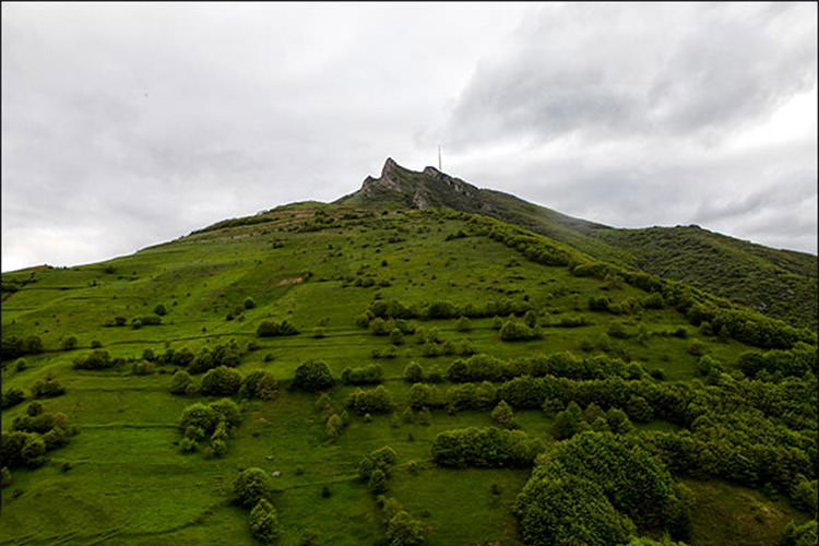
Ahar is not a city that reveals itself in a single afternoon. It sits in a wide valley at 1,360 metres above sea level, surrounded by the peaks of the Qareh-Dagh range, and it has been a crossroads of empires and ecosystems for more than two and a half thousand years. The Urartians left their mark on stone here. The Sassanids built fortresses on its ridges. Babak Khorramdin fought his twenty-two-year resistance against the Arab caliphate from these mountains. And above it all, the Arasbaran forests stretch in every direction, a UNESCO biosphere reserve that covers the higher slopes with oak, beech, and wild plum.
This is a place where you can climb a Parthian fortress in the morning, walk through a bazaar that has operated continuously for centuries in the afternoon, and spend the evening watching brown bears descend from the forests toward the villages. Ahar asks for at least two or three days, and it rewards every one of them.

Where is Ahar County?
Ahar County covers 3,074 square kilometres in the north-east of East Azerbaijan province, and it forms the largest urban centre in the Arasbaran region. The city of Ahar itself, with a population of around 100,000, sits 110 kilometres from Tabriz and serves as the main gateway to the wider Arasbaran area. The county borders Armenia to the north, Ardabil province to the east, and the counties of Varzeqan and Haris to the west and south.
The Ahar River (also called Kichik Chay) runs through the centre of the city, dividing it into eastern and western halves, and several other rivers, including Ahar Chay, Alireza Chay, and Rangul Chay, cross the county on their way toward the Qareh-Su valley. The city is enclosed by mountains on three sides: Shivar peak to the north-east, Bozqush to the south, and Qashqeh-Dagh to the south-east.
A brief history
Ahar's past is long and layered. Before Islam, the settlement was known as Uozanlar or Mimand, and it served as the seat of the Qareh-Dagh region. After the Islamic conquest, it became known as Ahar or Aharich. In the 6th and 7th centuries AH, it was briefly the capital of the Pishtakinid dynasty. During the Safavid period, the presence of Sheikh Shamseddin Aharī's shrine brought royal attention, and the city remained an important administrative centre.
In the Qajar era, Ahar became the command centre for Abbas Mirza during the first Russo-Iranian war. In 1941, the city was bombed by Soviet forces, and several residents were killed. More recently, Ahar was one of the centres of the Iranian Constitutional Revolution, and the region served as the territory of Babak Khorramdin's resistance movement.
The climate and when to come
Ahar has a mountainous climate, and the temperature range is extreme. Summer highs can reach 34°C, while winter lows drop to 27°C below zero. The best time to visit is late spring and summer, when the weather is mild, the forests are green, and the mountain roads are clear. Autumn brings spectacular colours to the Arasbaran forests, but temperatures drop quickly and early snow is possible by late October. Winter is cold and snowy, and many of the mountain roads and attractions become inaccessible.
Kamtal Mountain
Kamtal (also spelled Kental) is one of the most important peaks in the Arasbaran range, rising to 3,100 metres. It sits about 180 kilometres from Tabriz, on the road from Jolfa to Khoda Afarin, near the village of Nujeh Mehr. The mountain is rocky and steep, with multiple valleys including Jurjan, Dastgerd, Takhteh Bulaq, and Anjirlikh.
The climb from the Imamzadeh Seyyed Mohammad shrine on the eastern face takes about four hours to the summit, with a further three hours for the descent. The path becomes increasingly steep above the Takhteh Bulaq spring, reaching gradients of 25 degrees in places. From the summit, you can see the Aras River and the snow-capped peaks of the surrounding range.
Kamtal is also home to important wildlife, including mouflon, wild goat, wolf, leopard, and brown bear. Wild tulips bloom on the slopes in spring, and a local pine-like tree called Ardij grows in scattered stands across the mountain.
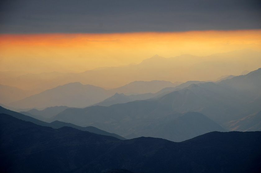
The Sassanid and Parthian fortresses
Ahar County has several ancient fortresses, and two of the most impressive are Qaleh Poshtab (also called Pishtu or Pishtab) and Qaleh Noduz (also called Naghdoz).
Qaleh Poshtab sits on the peak of Hashteh Sar mountain, 12 kilometres from Horand and 50 kilometres north-east of Ahar. The fortress was built at 3,000 metres elevation, and access is via 220 stone steps carved into the rock on the northern face. The other three sides drop away in sheer cliffs. The walls are built of rubble stone, clay mortar, and saruj, with some brick, and the structure dates to the Parthian and Sassanid periods. Multiple water cisterns have been carved into the rock, mostly on the northern side. From the fortress, you can see Qaleh Qahqah and the Qareh-Su river valley below. The fortress was registered as a national heritage site in 2008.
Qaleh Noduz rises 25 kilometres south-east of Ahar, on a peak above the Ahar Chay river. The main tower is 11 metres tall, built of carved sedimentary stone in brick-yellow and red colours, with lime and gypsum mortar. The fortress has two towers connected by a circular wall, and it dates to the Sassanid period. It was built for military purposes, with control over the surrounding mountains and the Noduz pass. The upper parts of the walls were originally built of mud brick, but rain has eroded most of this over the centuries.

Sheikh Shamseddin Aharī's shrine and museum
The tomb of Sheikh Shamseddin Aharī is one of the most important cultural sites in Ahar, and it is the only museum of literature and mysticism in Iran. The shrine dates to the Safavid period and was registered as a national heritage site. Inside the mosque, you can see calligraphy attributed to Sheikh Bahai, Shah Abbas III, and Abolqasem Nabati on the walls.
The museum houses manuscripts, literary artifacts, and objects related to Sufi traditions in Iran. It is a quiet, contemplative space, and it offers a different perspective on the region's cultural history beyond the military and natural attractions.
The bazaar and the Jameh Mosque
Ahar Bazaar is the second oldest covered bazaar in East Azerbaijan province, after Tabriz. It was built in two floors with brick domes and decorative elements, and it continues to function as a commercial centre for the city. The bazaar is a good place to find local souvenirs, including verni weaving, Ahar red apples, honey, and Yeti Qat bread.
The Jameh Mosque is another national heritage site, with 21 domes that have been added in various periods. The mosque is one of the oldest in the region, and its architecture reflects the layered history of the city.
The Shah Abbas caravanserai
The Shah Abbas caravanserai in Ahar is a national heritage site and one of the few mountain caravanserais in Iran. Its design was specifically adapted to the harsh winters and heavy snow of the region, with thick walls and a layout that protected travellers and their animals from the cold. The caravanserai is a reminder of Ahar's importance as a stop on the trade routes between Tabriz, Ardabil, and the northern territories.
The Sighin Dal rock inscription
The Urartian rock inscription at Sighin Dal village, near Ahar, is one of the oldest written records in the region. It dates to the Urartian period (9th to 6th centuries BC) and is carved into the face of a rock on the slope of Zaghi mountain. The inscription is evidence of the ancient presence of the Urartian kingdom in this area, and it is one of the few remaining examples of Urartian writing in Iran.
Natural attractions
Ahar County has a remarkable range of natural attractions, many of them within the Arasbaran biosphere reserve.
The Arasbaran forests are a UNESCO-listed biosphere reserve, covering the higher slopes of the Qareh-Dagh range with oak, beech, wild plum, and other deciduous trees. The forests are home to Persian leopard, brown bear, Caspian red deer, and numerous bird species. The region's biodiversity is among the highest in Iran, and the forests are particularly spectacular in autumn, when the leaves turn red and gold.
Yusfolo Wetland is a permanent wetland east of Ahar that serves as a habitat for migratory waterbirds. The wetland is an important stop on migratory routes, and birdwatching is possible throughout the spring and autumn migration periods.
Quch Goli Wetland sits in the Qushadagh highlands, and Dibsiz Wetland has been converted into the Shahverdi Qeshlaq dam. Both are worth a visit for their scenery and wildlife.
Aladaghlar (the Colorful Mountains) are visible from the Tabriz-Ahar road. The geological formation creates striking bands of colour in the rock, and it is one of the most photogenic natural sites in the region.
Yari Qari Protected Area is another natural zone in the county, with diverse plant and animal life.

Food and souvenirs
Ahar has a distinct culinary tradition, with dishes that reflect the mountainous climate and agricultural heritage of the region.
Sogan Soy is a local dish made with onions, and Arishteh is a type of noodle soup. Ahar Pitisi is another traditional dish, though the exact ingredients vary by family recipe.
The most famous souvenir is Yeti Qat bread, a traditional flatbread that has been registered as a national intangible heritage. Yookha bread (a type of thin flatbread), Ahar red apples, natural honey, verni weaving (a traditional textile with a history of more than three centuries), and wooden musical instruments are all available in the bazaar and make excellent gifts.
How to get there
By air. The nearest airport is Tabriz International Airport, about 140 kilometres from Ahar. From the airport, you can rent a car or take a taxi to Ahar. The drive takes about two hours via the main highway.
By car. From Tabriz, take the highway north-east toward Ahar. The distance is 110 kilometres, and the drive takes about 90 minutes to two hours depending on traffic and road conditions. The road passes through several towns and offers views of the surrounding mountains. Open Mehyar and book a Taxi for a comfortable ride with the flexibility to stop at viewpoints along the way.
By bus. Buses run from Tabriz to Ahar regularly, and the journey takes about two to two and a half hours. Mehyar Buses also serve this route, and you can check schedules and book tickets in the app. From the Ahar bus terminal, you can take a local taxi to your accommodation or to specific attractions.
By train. Ahar does not have a train station. The nearest rail access is in Tabriz.
On-site mobility. Within Ahar city, taxis and local transport are available. For visiting the more remote attractions like Kamtal Mountain, Qaleh Poshtab, or the Arasbaran forests, you will need a private car or a hired driver. Some roads to the higher elevations are unpaved and may require a 4WD vehicle, especially after rain or snow.
Where to stay
Accommodation options in Ahar are limited. Hotel Razavi is the main hotel in the city, and it offers basic but comfortable rooms. For a more immersive experience, consider the eco-lodges in the surrounding villages, which provide a chance to experience local hospitality and cuisine.
Practical tips
- Allow at least two or three days to see the main attractions. A single day is not enough for the fortress climbs, the museum, and the natural sites.
- Bring layers. The mountain climate means temperatures can change quickly, especially at higher elevations.
- Check road conditions before heading to Kamtal, Qaleh Poshtab, or other remote sites. Mountain roads may be closed after heavy rain or snow.
- The Arasbaran forests are a UNESCO biosphere reserve. Respect the environment, stay on marked paths, and do not disturb wildlife.
- The bazaar is the best place for souvenirs. Look for verni weaving, local honey, and Yeti Qat bread.
- Combine with Tabriz. Ahar is only 110 km from Tabriz, and you can easily visit both in a longer trip. Tabriz has its own bazaar (a UNESCO World Heritage Site), the Blue Mosque, and the El Goli park.