
When UNESCO admitted Qeshm Geopark to its Global Geoparks Network in 2006, it was a first. No site in the Middle East had earned the designation before. The geopark sits on Qeshm Island in the Persian Gulf, in Hormozgan Province, and it covers a landscape so geologically diverse that scientists still debate how many of its features deserve separate classification. There are salt caves longer than any in Europe, canyons carved by water over millions of years, mangrove forests that flood twice a day, and valleys where wind has turned rock into something that resembles a frozen wave. This guide walks through what makes the geopark unique, which geosites deserve your time, and how Mehyar can handle the logistics of getting there and moving around.
What Is a Global Geopark?
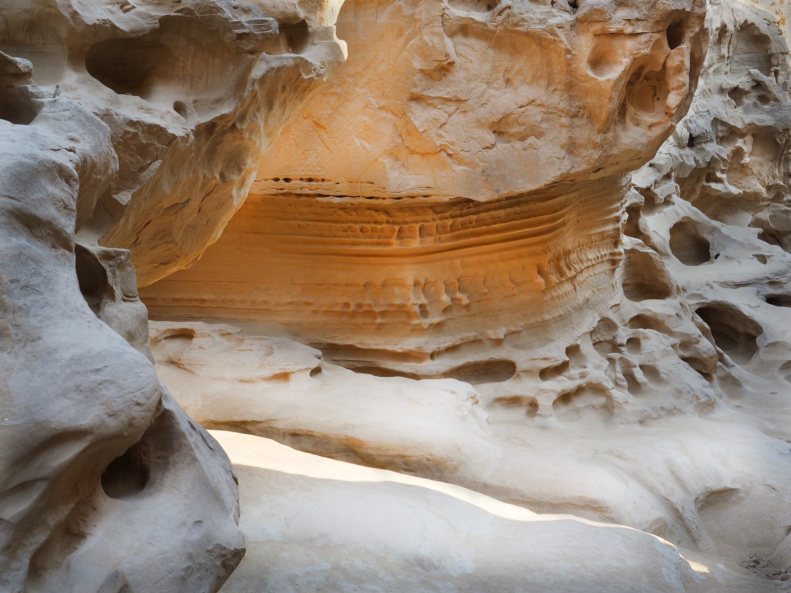
A UNESCO Global Geopark is not a theme park or a fenced reserve. It is a territory that combines geological significance with ecological and cultural value, managed under a framework that balances conservation with sustainable tourism. The designation requires scientific documentation, community involvement, and a management plan. Qeshm qualified because of its concentration of rare geological formations, its mangrove ecosystems, its archaeological record stretching back over 150,000 years, and the living culture of the island's villages.
The geopark was admitted at a UNESCO meeting in Paris in 2006. It was temporarily removed from the network in the early 2010s due to management concerns but was reinstated in 2017. Today it remains Iran's only Global Geopark and a point of national pride.
The Major Geosites
Valley of Stars (Darreh-ye Setaregan)
About 15 kilometers from Qeshm city, near the village of Berkeh Khalaf, the Valley of Stars is the geopark's most visited site. Seasonal rain and wind have eroded the soft sedimentary rock into pillars, spires, and hollows that look like a landscape from another planet. Local legend says the shapes were formed when a star fell to earth, and the eerie wind sounds that pass through the formations at night gave the valley its name.
The best light comes in early morning and late afternoon, when shadows stretch across the rock and the textures deepen. The ground is uneven and sandy, so wear closed shoes with grip. Bring water, because there is no shade and no concession stand. Entry is free, and a relaxed walk through the main area takes about an hour.
Chahkooh Canyon (Tangeh-ye Chahkooh)
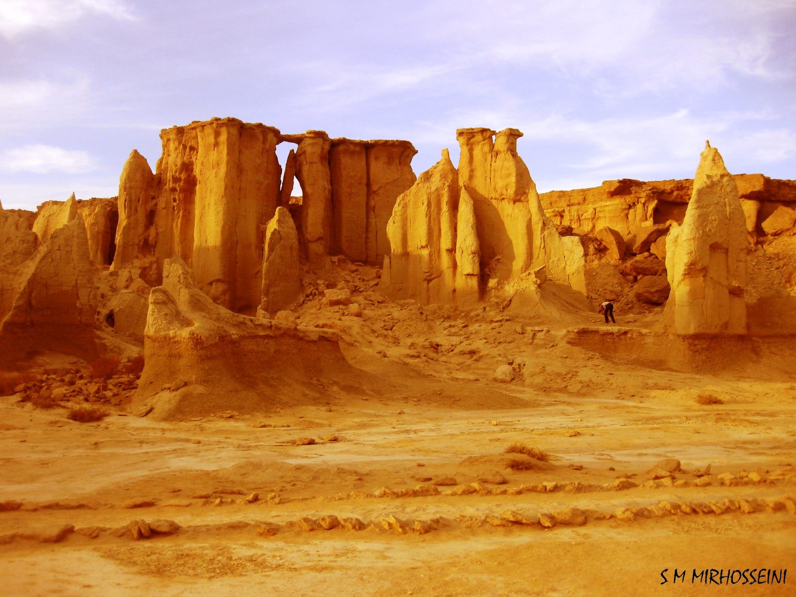
Chahkooh is a narrow gorge in the western part of the island, near the village of Chahou-e Sharqi. The name means "well mountain," referring to the historic wells that locals dug at the entrance to harvest rainwater. The canyon walls rise up to 100 meters in places, and the passage narrows as you advance, until the sky becomes a thin ribbon above you.
The geology is sedimentary rock shaped by water and wind over millions of years. The surfaces are smooth in some sections and deeply pitted in others, with holes and ledges that catch the light in striking patterns. It is a site that rewards patience. Walk slowly, listen to the echo of your steps, and let the scale sink in. Entry is free, and the main section takes one to two hours to explore. Sturdy shoes are essential, and you should avoid the canyon during or immediately after rain, when the floor becomes slippery and flash floods are possible.
Namakdan Salt Cave (Ghar-e Namakdan)
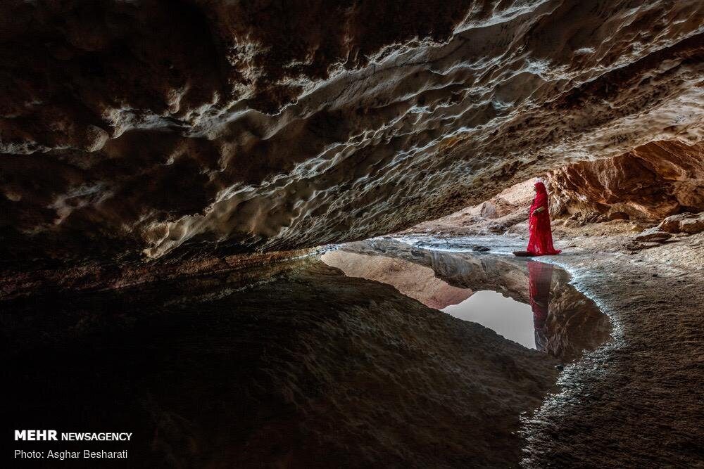
The Namakdan Salt Cave is one of the geopark's most extraordinary features. Located about 90 kilometers from Qeshm city, inside the salt dome in the western part of the island, the cave stretches at least 6.4 kilometers, making it one of the longest salt caves in the world. It is also known as the "Three Naked Men Cave," a reference to the shape of three salt columns near the entrance that resemble standing figures.
Inside, salt stalactites and stalagmites form intricate patterns on the ceiling and floor. The salt deposits glow with a faint translucence when light passes through them. The cave is a registered national natural heritage site, and the visit typically takes two to three hours with a guide. Entry is free, but hiring a local guide is strongly recommended, both for safety and because the deeper sections are easy to get lost in. If you are visiting the geopark, the salt cave is worth the longer drive from Qeshm city.
Hara Mangrove Forests
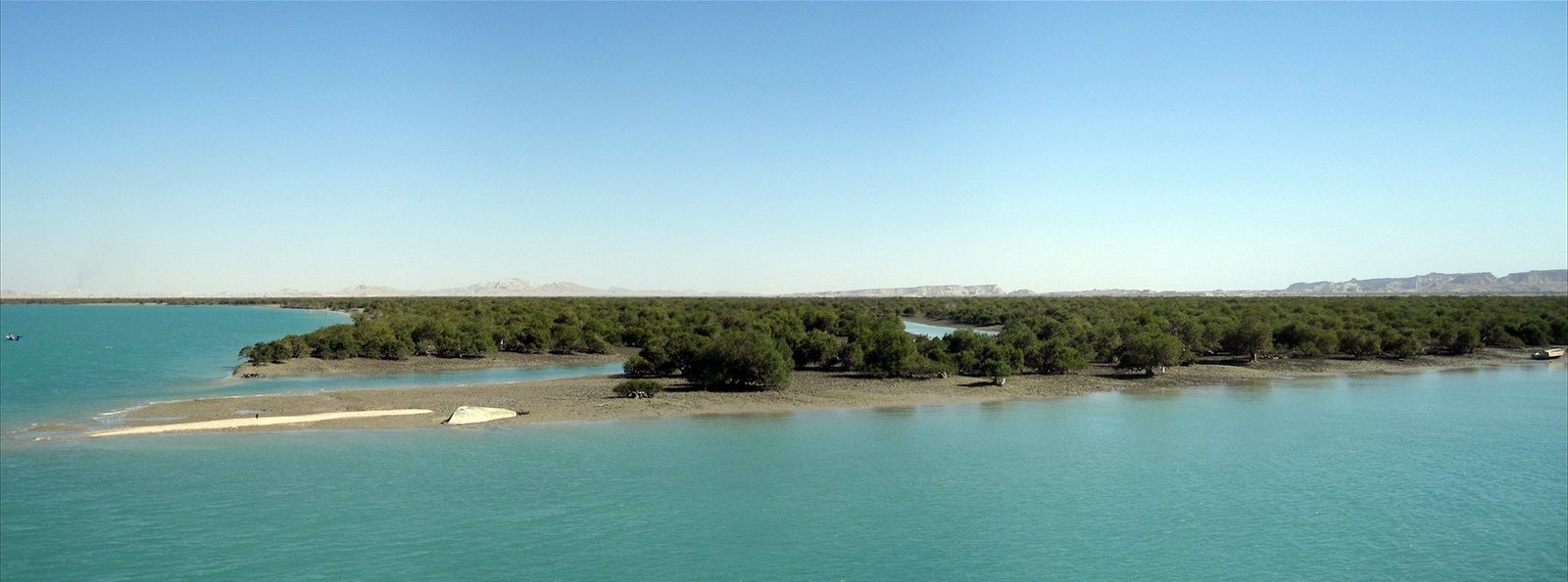
The Hara Forests grow in the shallow tidal waters along the northern coast of Qeshm, where they meet the Khuran Strait. These are not ordinary forests. The mangrove trees, primarily of the Avicennia marina species, thrive in saltwater and survive cycles of flooding and exposure that would kill most plants. At high tide, the forests disappear beneath the water, and only the canopy crowns remain visible. At low tide, the complex root systems emerge, creating a labyrinth that shelters fish, birds, and crustaceans.
The Hara Forests are a registered RAMSAR wetland site of international importance. They are home to herons, egrets, and the elusive eaglenose turtle, one of the geopark's seven natural wonders. Boat tours depart from several points along the northern shore and typically last one to two hours. You can book a boat through Mehyar Experiences, which handles the reservation and payment through the app.
Bam-e Qeshm
Bam-e Qeshm is the highest point on the island and offers a panoramic view across the western geopark sites. From the summit, you can see the Chahkooh Canyon to the west, the mangrove forests to the north, and the open waters of the Persian Gulf stretching to the south. The climb takes about an hour from the nearest road, and the geological layers visible along the trail tell the story of millions of years of sedimentation and uplift.
The Naz Islands
The Naz Islands are a pair of small islets off the southern coast of Qeshm that become connected to the main island by a natural causeway at low tide. Walking across the exposed seabed to reach the islands is one of the most unusual experiences in the geopark. The causeway appears and disappears with the tides, so timing matters. Check the tide schedule locally before setting out, and do not attempt the crossing if the water is rising.
The Seven Wonders of Qeshm
Local tourism authorities promote seven natural wonders within the geopark, and they provide a useful framework for planning your visit:
- Valley of Stars (erosion-carved rock formations)
- Hara Forests (mangrove wetlands)
- Eaglenose Turtles (a rare marine species nesting on the island's beaches)
- Naz Islands (tidal causeway islets)
- Chahkooh Canyon (water-carved gorge)
- Hengam Dolphins (spinner dolphins in the waters around Hengam Island, visible from December to April)
- Namakdan Cave (the great salt cave)
How to Get to Qeshm Geopark
The geopark is not a single entrance with a ticket booth. It is a network of sites spread across the western and central parts of Qeshm Island. You reach it by first getting to Qeshm, then driving to each geosite.
By air: Qeshm International Airport receives daily flights from Tehran, Mashhad, Isfahan, and other major Iranian cities. Book your flight through Mehyar Flights, compare dates, and pay with the Mehyar wallet. From the airport, the geopark's western sites are roughly a 45-minute drive.
By ferry: Passenger ferries run from Bandar Abbas to Qeshm roughly every hour during daylight. The crossing takes about 50 minutes.
By car: Drive to Bandar Pol, about 70 kilometers from Bandar Abbas, and load your car onto a landing craft for the 20-minute crossing to Bandar Laft on Qeshm.
Once on the island, the most practical way to visit the geosites is by car. You can book a driver through Mehyar Taxi for the day, which lets you cover multiple sites at your own pace.
Hours, Fees, and Practical Details
Most geosites inside the geopark have no entry fee and no gate. The Valley of Stars, Chahkooh Canyon, and the Naz Islands causeway are all free to visit. The Namakdan Salt Cave benefits from a local guide, and you should agree on a price before setting out. The geopark museum near the western end of the island may charge a small admission.
The best months to visit are October through April, when daytime temperatures range from about 18 to 30 degrees Celsius. Summer on Qeshm is extremely hot and humid, with temperatures regularly above 40 degrees, and some geosites become uncomfortable or unsafe in the midday heat.
Plan Your Trip with Mehyar
Mehyar covers every part of a Qeshm Geopark trip. Search and book flights to Qeshm, reserve hotels and eco-lodges on the island, book a taxi with a driver for geopark days, and browse experiences like mangrove boat tours and guided cave walks. Top up your Mehyar wallet before you go, and pay for everything from one place. If you are combining Qeshm with a visit to Kish Island or Hormuz Island, Mehyar handles the ferry bookings and island transfers as well.
For the best timing and conditions, check the best time to visit Iran guide, which covers seasonal patterns across the southern coast and the Persian Gulf.