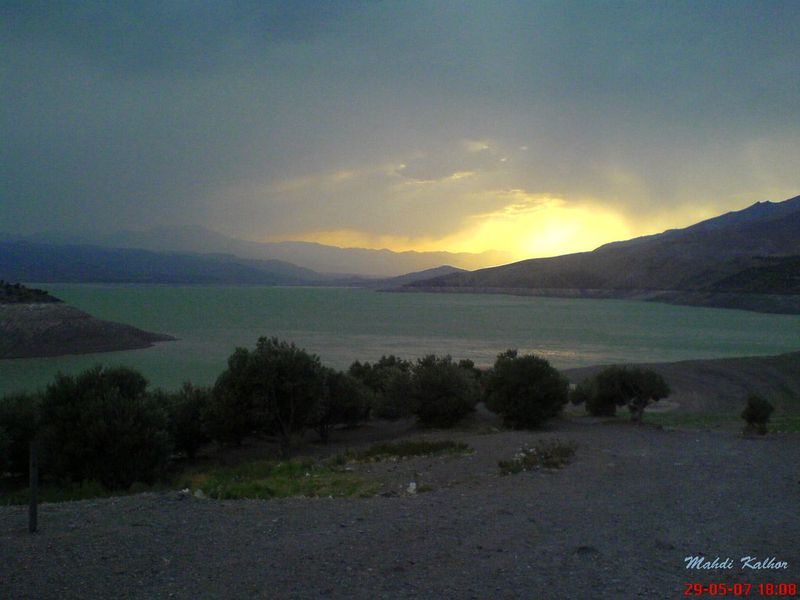
The Alborz Mountains stretch across northern Iran like a great stone spine, and along their western flanks, where the roads climb out of the Qazvin plain and curve toward the Caspian slopes, a number of quiet valleys hold places that few visitors know. Taleghan county is one of those valleys. It sits in a broad basin ringed by peaks, fed by snowmelt and springs that tumble down from elevations above three thousand metres. Among the attractions of this mountainous county, Bashar Shale Bin stands out as a place where the landscape speaks in the language of water and stone. The waterfall is the tallest in Taleghan, and reaching it requires a walk through some of the most unspoiled scenery in the Alborz foothills, a landscape of walnut groves, wildflower meadows, and grey limestone ridges that catch the early light and hold it well into the afternoon.

Where is Bashar Shale Bin?
The waterfall is located in Taleghan county, which was historically part of Tehran province and is now administered as part of Alborz province. Taleghan lies roughly one hundred and thirty-five kilometres west of Tehran, reached by a road that follows the Qazvin freeway before branching northward into the mountains. The county occupies a wide intermontane valley, sometimes called a bowl, surrounded on three sides by the peaks of the Alborz range. The elevation of the valley floor sits at around eighteen hundred metres, while the enclosing ridges rise to over three thousand metres. This vertical range creates a variety of microclimates within a short distance, and the vegetation shifts from oak woodland in the lower slopes to alpine meadow near the summits.
Bashar Shale Bin itself is situated in a side valley on the southern slopes of the range, where a seasonal stream drains snowmelt from the higher peaks. The waterfall is sometimes referred to locally as Sholeh Bon or Khosban waterfall, after the nearest village. The name varies in spelling across sources, but the place it describes is unmistakable. A cascade of clear water descending through layers of limestone, feeding pools of startling clarity before continuing its course toward the valley floor and eventually into the Taleghan river system.
The Waterfall and Its Setting
What distinguishes Bashar Shale Bin from other waterfalls in the Alborz is not its height alone, though it is the tallest cascade in the county, but the quality of its setting. The water falls in a series of tiers rather than a single vertical drop, each tier feeding a rock basin before spilling over the next ledge. The limestone around the falls is stained with minerals and covered in patches of moss where the spray keeps the stone moist, creating a palette of green, amber, and grey that shifts with the changing light.
The gorge that frames the waterfall is narrow enough that you feel enclosed by the rock faces on either side, yet open enough to see the sky above and the vegetation climbing away from the stream banks. In spring, when the snowmelt is at its peak, the water runs white and forceful, filling the channels and sending spray into the air. By late summer, the flow diminishes to a gentler pace, and the pools between the tiers become still enough to reflect the surrounding stone and sky. The seasonal variation is part of the experience. Each visit at a different time of year offers a different encounter with the same place.

The vegetation around the waterfall is notably rich for this part of the Alborz. The lower slopes of Taleghan support stands of oak, almond, and pistachio, while the moister north-facing slopes carry denser cover of hawthorn, maple, and wild rose. Around the waterfall, where the spray provides constant moisture, you will find ferns, grasses, and flowering plants that thrive in the cool microclimate. Birdlife includes swifts and swallows that hunt insects over the water, along with rock thrushes that move among the boulders. The valley is quiet enough that you are likely to hear the water and the wind before you notice anything else.
Taleghan Valley and Its Villages
The waterfall does not exist in isolation. It is part of a landscape that has been shaped by both geology and human habitation over thousands of years. Taleghan county is home to dozens of villages, many of them built from the local stone and mudbrick, with flat roofs and thick walls designed for the cold winters and warm summers of the high valley. The villages are scattered along the river and its tributaries, surrounded by terraced fields and orchards that depend on the same snowmelt that feeds the waterfall.
The people of Taleghan have traditionally lived from agriculture and animal husbandry, with walnut and almond orchards providing a significant part of the livelihood. The walnut trees of Taleghan are famous in the region, and in autumn the village streets are covered with husks drying in the sun. The orchards create a landscape that is half-wild and half-tended, and walking from the villages toward the waterfall, you pass through this gradient of cultivated and natural terrain. The transition is gradual, and the boundary between garden and mountain is often unclear.
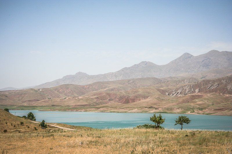
Taleghan also has a dam and reservoir, which form a lake at the eastern end of the valley. The lake is a relatively recent addition to the landscape, created by the construction of the Taleghan Dam, but it has become an attraction in its own right. The combination of the lake, the mountains, and the villages makes the county a destination for those seeking a retreat from the cities of the plain. Bashar Shale Bin is one of the natural highlights of a visit, a place where the geological and the botanical come together in a single setting.
History and Cultural Context
Taleghan has a long history of settlement, and its strategic position in the Alborz passes has made it a waypoint for travellers and traders moving between the Caspian provinces and the central plateau. The valley has been inhabited since at least the early Islamic period, and its villages have maintained a degree of independence and self-sufficiency that is characteristic of mountain communities throughout Iran.
The name Taleghan appears in historical sources from the tenth century onward, and the valley has been described by geographers and travellers as a place of abundant water and fertile soil. The waterfall at Bashar Shale Bin has not always been named in these early accounts, as the practice of identifying specific natural attractions for tourism is relatively recent, but the waterfall has long been known to the people of the villages above and below it. For them, it was part of the water system that sustained their fields and orchards, a landmark on the seasonal routes between summer and winter pastures.
Practical Information
Bashar Shale Bin is a natural site with no formal entrance or facilities. There are no tickets or opening hours. The waterfall is accessible on foot from the nearest village, and the walk takes approximately one to two hours depending on your pace and the condition of the trail. The path follows the stream for much of the way, and it involves some uphill sections and uneven ground. Sturdy footwear is recommended, and in spring when the snowmelt is running strongly, the rocks near the waterfall can be slippery.
There are no shops or restaurants at the waterfall itself, so bring water, food, and any supplies you will need for the day. The nearest villages have small shops and occasionally offer tea and simple meals to visitors. If you are planning a longer stay in the area, the town of Taleghan has guesthouses and basic accommodation, and there are camping opportunities in the valley for those who bring their own equipment.
Best Time to Visit
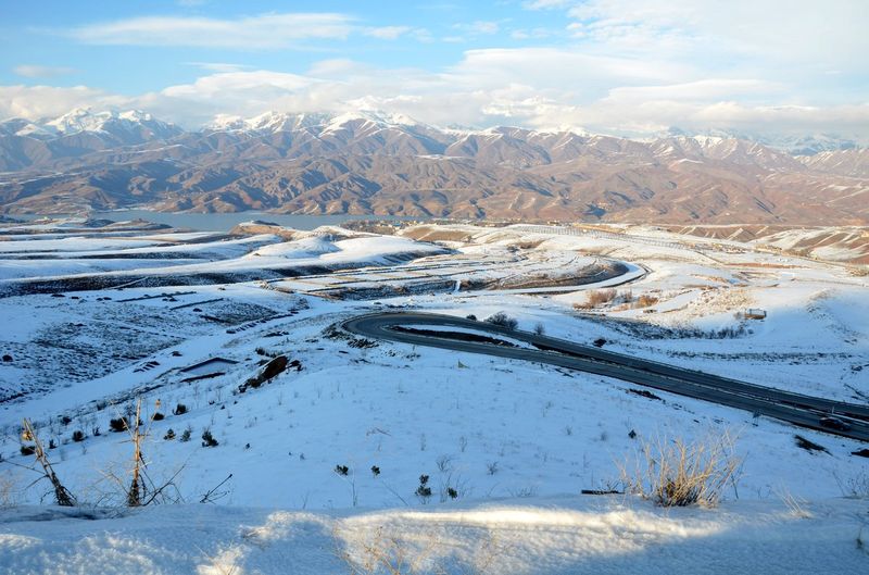
The best time to visit Bashar Shale Bin is from late April through June, when the snowmelt is at its peak and the waterfall is running at full force. The meadows around the waterfall are in bloom during this period, and the valley is green and fragrant with wildflowers. July and August are also pleasant, though the flow of the waterfall diminishes as the snowpack reduces. Autumn brings golden colours to the walnut groves and a cooler climate, and the valley is beautiful in October, though the waterfall will be at its lowest flow by then.
Winter is generally not recommended for visiting the waterfall, as the trails can be snow-covered and the temperatures in the valley drop well below freezing. The roads to Taleghan are maintained through the winter, but the walk to the waterfall requires experience with snow and ice conditions if attempted between December and March.
How to Get There
Open Mehyar and choose Taxi from Tehran to reach Taleghan. The drive covers roughly one hundred and thirty-five kilometres and takes about two hours on the freeway to Qazvin and then northward into the mountains. The road to Taleghan is paved and well-maintained, and the scenery along the way is worth attention. You pass through the foothills of the Alborz, with views of the range growing closer as you approach the valley.
Mehyar Buses connects Tehran to Qazvin and other cities along the route. From Qazvin, you can continue to Taleghan by local transport or taxi. The journey from Qazvin to Taleghan takes approximately one hour. If you are coming from Karaj, an alternative route goes through the Chalus road and then eastward into the Taleghan valley, though this is a longer drive and more suited to those combining the visit with other destinations in the Alborz.
From Taleghan town, follow the road toward the villages on the southern slopes. The nearest village to the waterfall is accessible by car on a dirt road that is passable in dry conditions. From the village, the trail to Bashar Shale Bin is marked in places and follows the stream upstream. Ask locals for directions if the signs are unclear, as the valley residents know the waterfall well and are happy to guide visitors.